Click here to hear real Vietnam Battle Radio Transmission including fire mission and Dustoff
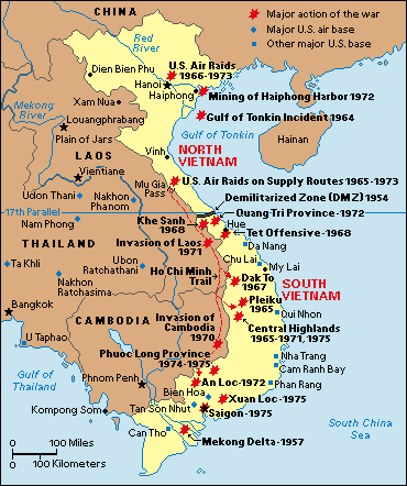
Vietnam War: Major Battles. This map shows the locations of major battles and other actions during the Vietnam War (1957-1975), as well as major United States military bases. The war was fought mainly in North and South Vietnam. Troops also battled in Laos and Cambodia, and U.S. pilots flew missions from bases in Thailand. In the war, U.S. and South Vietnamese forces fought against Communist-trained South Vietnamese rebels and North Vietnamese troops.
Click here to download 1 ATF Maps
The Vietnam War was the longest major conflict in which Australians have been involved; it lasted ten years, from 1962 to 1972, and involved some 60,000 personnel. A limited initial commitment of just 30 military advisers grew to include a battalion in 1965 and finally, in 1966, a task force. Each of the three services was involved, but the dominant role was played by the Army.
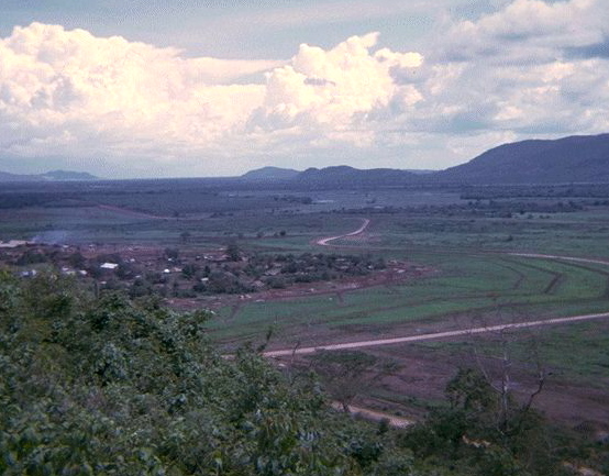
The View from SAS Hll to the Warbies
In the early years Australia’s participation in the war was not widely opposed. But as the commitment grew, as conscripts began to make up a large percentage of those being deployed and killed, and as the public increasingly came to believe that the war was being lost, opposition grew until, in the early 1970s, more than 200,000 people marched in the streets of Australia’s major cities in protest.
By this time the United States Government had embarked on a policy of ‘Vietnamisation’ - withdrawing its own troops from the country while passing responsibility for the prosecution and conduct of the war to South Vietnamese forces. Australia too was winding down its commitment and the last combat troops came home in March 1972. Involvement in the war cost more than 500 Australian servicemen their lives, while some 3,000 were wounded, otherwise injured or were victims of illness.
 The South Vietnamese fought on for just over two years before the capital, Saigon, fell to North Vietnamese forces in April 1975, bringing an end to the war which by then had spilled over into neighbouring Cambodia and Laos. Millions lost their lives, millions more were made refugees and the disaster that befell the region continues to reverberate today. For Australia the Vietnam War was the cause of the greatest social and political dissent since the conscription referenda of the First World War. The South Vietnamese fought on for just over two years before the capital, Saigon, fell to North Vietnamese forces in April 1975, bringing an end to the war which by then had spilled over into neighbouring Cambodia and Laos. Millions lost their lives, millions more were made refugees and the disaster that befell the region continues to reverberate today. For Australia the Vietnam War was the cause of the greatest social and political dissent since the conscription referenda of the First World War.
Once Phuoc Tuy had been selected as the provincial site for Australia’s task force, a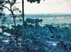 location for its base had to be chosen. There were three possibilities: Ba Ria, Phuoc Tuy’s capital; the port of Vung Tau; and an area in the province’s central region known as Nui Dat, Vietnamese for ‘small hill’. location for its base had to be chosen. There were three possibilities: Ba Ria, Phuoc Tuy’s capital; the port of Vung Tau; and an area in the province’s central region known as Nui Dat, Vietnamese for ‘small hill’.
Removed from population centres but close to Viet Cong base areas, Nui Dat was considered ideal for the type of counter-insurgency warfare that Australians waged in Phuoc Tuy. Its location in the centre of the province meant that Nui Dat was in the middle of Viet Cong territory. Therefore, security was of prime importance. The villages nearest Nui Dat – Long Tan and Long Phuoc – were both considered Viet Cong strongholds and the Australian task force’s first commander, Brigadier O.D. Jackson, with the agreement of the Province Chief, had the people and livestock of the two villages forcibly resettled. The removal of the local people from the vicinity meant that the chances of the Viet Cong gathering information about the base and the movement of Australian troops were significantly reduced. However, attempts to win the support of Phuoc Tuy’s people were compromised by the decision to remove people from their homes without compensation.
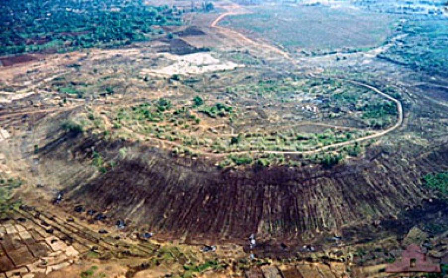
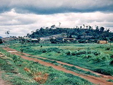
The Horseshoe
The base was established by members of the United States 173rd Airborne, the 1st Battalion, Royal Australian 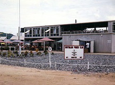 Regiment (1RAR) and the newly arrived 5th Battalion, Royal Australian Regiment (5RAR). The first soldiers to occupy it lived in tents and worked to establish defences. Every soldier at Nui Dat had a fighting pit. Elevated bunkers, manned 24 hours a day, were constructed around the base’s perimeter which was further defended by wire obstacles and belts of anti-personnel mines. Vegetation was cleared from a 500-metre wide area outside the wire to provide fields of fire and a clear view of approaching Viet Cong. Regiment (1RAR) and the newly arrived 5th Battalion, Royal Australian Regiment (5RAR). The first soldiers to occupy it lived in tents and worked to establish defences. Every soldier at Nui Dat had a fighting pit. Elevated bunkers, manned 24 hours a day, were constructed around the base’s perimeter which was further defended by wire obstacles and belts of anti-personnel mines. Vegetation was cleared from a 500-metre wide area outside the wire to provide fields of fire and a clear view of approaching Viet Cong.
Iroquois helicopters (Hueys) flown by 9 Squadron RAAF arrive at Kangaroo Pad, Nui Dat from their base at Vung Tau, 1966.
At its peak the base at Nui Dat was home to some 5,000 Australian personnel, but for much of the time most of them were deployed on operations outside the base.
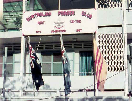
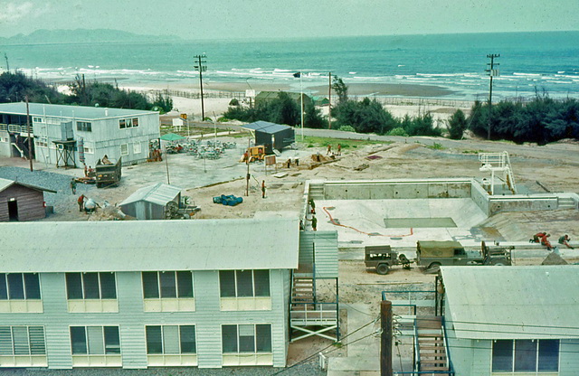
Rest and Convelesence Centre Vung Tau
Peter Badcoe Club - Rollover with your mouse to see what it is today.
View Larger Map
View Australian Disposition 1965/66 in a larger map
View Australian Fire Support Bases(FSB) in a larger map
View Australian Vietnam War Ops 1968 in a larger map
Phuoc Tuy Province - South Vietnam Videos
Vietnam Scene
These excerpts from a longer Defence Public Relations film shows scenes of Vietnamese people going about their daily lives apparently in peace, despite the presence of military vehicles in some shots. Helping to establish this peace, says the films narrator, are the Australians whose bases at Vung Tau and Nui Dat appear in the film which also shows Australian soldiers carrying out their routine duties. This video requires Adobe Flash Player to be installed.
Clip 1: Ground-level footage of the major roads in the region surrounding 1ATF’s base at Nui Dat, in particular Route 15, Route 2, Route 23 and Route 44.
Clip 2: Footage of the maze of tidal waterways and swamps south of Ba Ria and northeast of the Mekong Delta. - 3 min.
Clip 3: Ba Ria, Dat Do, Long Tan, Binh Ba, Binh Gia. - 2 min 43 sec.
|
|